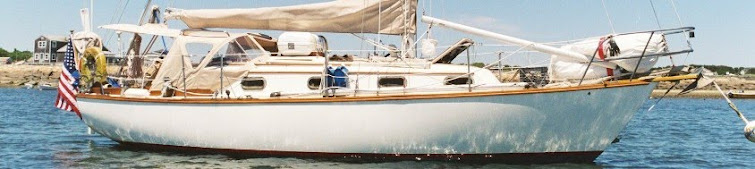
%40-01+016a.jpg)
 I reluctantly slipped the lines at Mystic Seaport Museum Friday morning, 10 September, and caught the ebb down the Mystic River to Long Island Sound. Nina elected to savor the Seaport for a few more days but we wanted to make miles west and enjoyed a fair tide through western Fishers Island Sound (chart right) in bright sunshine and perfect visibility. An unwelcome chop at the mouth of the Thames River reminded me that the journey was not over yet and the wind, predicted to be 5 to 10 NW, held steady at about 15 NW and then began to creep upward.
 I'd intended to make the Thimble Islands this day but by 1230, still some 14 NM short of the goal and with the wind gusting NW at 25, I'd had enough. I altered course to the NW aiming for Duck Island Roads (chart at left). In this wind the anchorage near the right-angled jetties would not be safe (if it ever is), but I hoped to find shelter under the lee of the mainland in the northwest part of the small bay just east of Kelsey Point. I dropped the anchor at 1245 (in N41-16-077/W72-29-219) as the clear and gusty NW wind continued at about 25 knots. The holding was excellent but a roll was making its way around the Kelsey Breakwater and the anchorage, although snug under the circumstances, was not comfortable.
About 2 hours later it seemed the wind had gone off a bit so I decided to try once again for the Thimbles and flat water. This time I was beaten back before even making it around the breakwater. However I was able to find smoother water about 0.9 NM from my original spot in N41-15-468/W72-30-114 (the reason I've included coordinates is to demonstrate the effects that even a slight change in position can have on comfort). Here the anchorage was an order of magnitude better and I decided to spend the rest of the day right where I was. The wind by this time had convinced many other boats to call it a day and the bay was almost getting crowded. For reasons I never did discover, several boats anchored in the "vee" created by the Duck Island Roads breakwaters despite the fact that they were facing into a strong NW breeze with the breakwaters forming a dangerous lee shore close behind. This made no sense to me and still doesn't but as they say, "different ships, different long splices."
 We got underway at 0550 the next morning, Saturday the 11th of September. The dawn broke cool and clear with NW winds at 8 to 10 knots and smooth seas. The goal this time was Cockenoe Harbor in the Norwalk Islands off the Connecticut south shore (photo right). I'd anchored there in 1996 in a friend's Cal 2-46 and I recalled a fairly comfortable spot with a great view, plenty of privacy, but a mildly tricky entrance into the harbor among rocks and shoals. The ride itself was somewhat bumpy across the entrance to New Haven Harbor but it settled down off Bridgeport and since it was Saturday the local "fleet" was tuning up for the races. The contrast of sailors playing in the sun and the fact that this was the 9th anniversary of Nine/Eleven was not lost on me. We anchored in Cockenoe Harbor just before 1400 and despite the SE breeze that stayed with us during the night and the mild roll it generated, the anchorage was satisfactory. I didn't say "comfortable," but "satisfactory" will do in a pinch.
 The next day, Sunday, was a big one when it came to making miles. The SE breeze of the previous evening had filled in during the night and by dawn we were staring into 20 to 25 SE in the anchorage with fairly large rollers making across the Long Island Sound. We hauled anchor at 0635 and made our way out into the Sound, soon settling on a course of 250 M for the Throggs Neck (photo left). This put the breeze on the port quarter and with 1.5 to 2 knots of fair tide, the 110% Genoa set, and the diesel just kicking over, we were moving well. I'd planned to stop at Port Washington until I noticed that the current at Hell Gate went favorable at 1330. My calculations indicated we would reach the Throggs Neck at 1200 or so, and that meant that if we kept going we would make the Gate just about when the tide went favorable. That's exactly what happened.
 A mile or so past the Throggs Neck Bridge I noticed a smart looking large cutter coming up on us and doing so in a determined fashion. As she approached I recognized the yacht Brendan's Isle (photo right) owned by Mike and Kay Arms (http://www.myronarms.com/), old friends from the Sassafras River on Chesapeake Bay. I hadn't seen Mike in many years and thought it rather a nice surprise that we were both transiting the East River at the same time. Mike and Kay were returning from a summer of cruising the Maine coast. What made the coincidence noteworthy was that Mike is a well known author who has written extensively about the areas I had been exploring all summer, particularly Newfoundland. We were able to catch up a bit on comings and goings of mutual old friends until he continued on out of sight down the East River.
 Soon we too were passing through Hell Gate and down the East River. As we ran between the Battery and Governor's Island, a combination of haze, light rain, and fog obscured the Statue of Liberty and made for a dicey crossing of the Upper Bay amid ferry and commercial traffic, but by 1500 we'd anchored safely behind the Statue just west of Liberty Island. As darkness fell visibility improved and we were treated to a magnificent view of the Statue and Lower Manhattan. The anchorage itself was surprisingly flat and quiet, and we enjoyed a peaceful Sunday evening rest in preparation for an early start down the New Jersey Coast.
 By 0430 Monday morning we were underway down harbor toward the Verrazano Narrows Bridge (photo right). The night was clear, visibility was excellent, and we enjoyed a huge fair tide down bay. Yet paradoxically there was just too much to see. The AIS was showing well over 100 targets of all shapes and sizes, and the direct path to the Narrows was filled with anchored commercial vessels, moving ferry boats, tugs with and without barges, and difficult-to-see aids to navigation. The radar also showed so many targets that it was difficult if not impossible to process all the information. Once clear of the Liberty Island entrance channel I immediately turned left and headed for the Brooklyn shore and the relative safety of Buttermilk Channel. I continued down harbor on the Brooklyn side and there encountered "only" four commercial vessels until finally passing under the Verrazano Bridge into the Lower Bay. From there it was only a matter of following the buoys and waiting for the relative security of the sunrise and the visibility that would come with it. My advice to all is that if possible, do not pass through the main channel in New York Harbor in darkness, regardless of your experience level or equipment.
The rest of the day passed uneventfully. We enjoyed a fair tide all the way down the New Jersey coast and entered Manasquan Inlet at 1100, passed through a turbulent Point Pleasant Canal with a fair tide shortly thereafter, and tied up in our old boat yard at 1400. The Newfoundland adventure had exceeded my expectations, but I was not at all unhappy to finally step ashore.
No comments:
Post a Comment